The Swedish west-coast
The Swedish west-coast stretches from Malmö (the third largest city in Sweden) up to the Norwegian border. The southern part from Malmö and north up to Gothenburg (the second largest city in Sweden) has a few islands and most of this part is unprotected from waves and winds coming from west (the most common wind direction). From the Gothenburg area and up to the Norwegian border there are thousands of islands of various sizes. This means when going north from Gothenburg by boat you can choose to travel either sheltered by various islands or outside them for faster sailing (and larger waves).
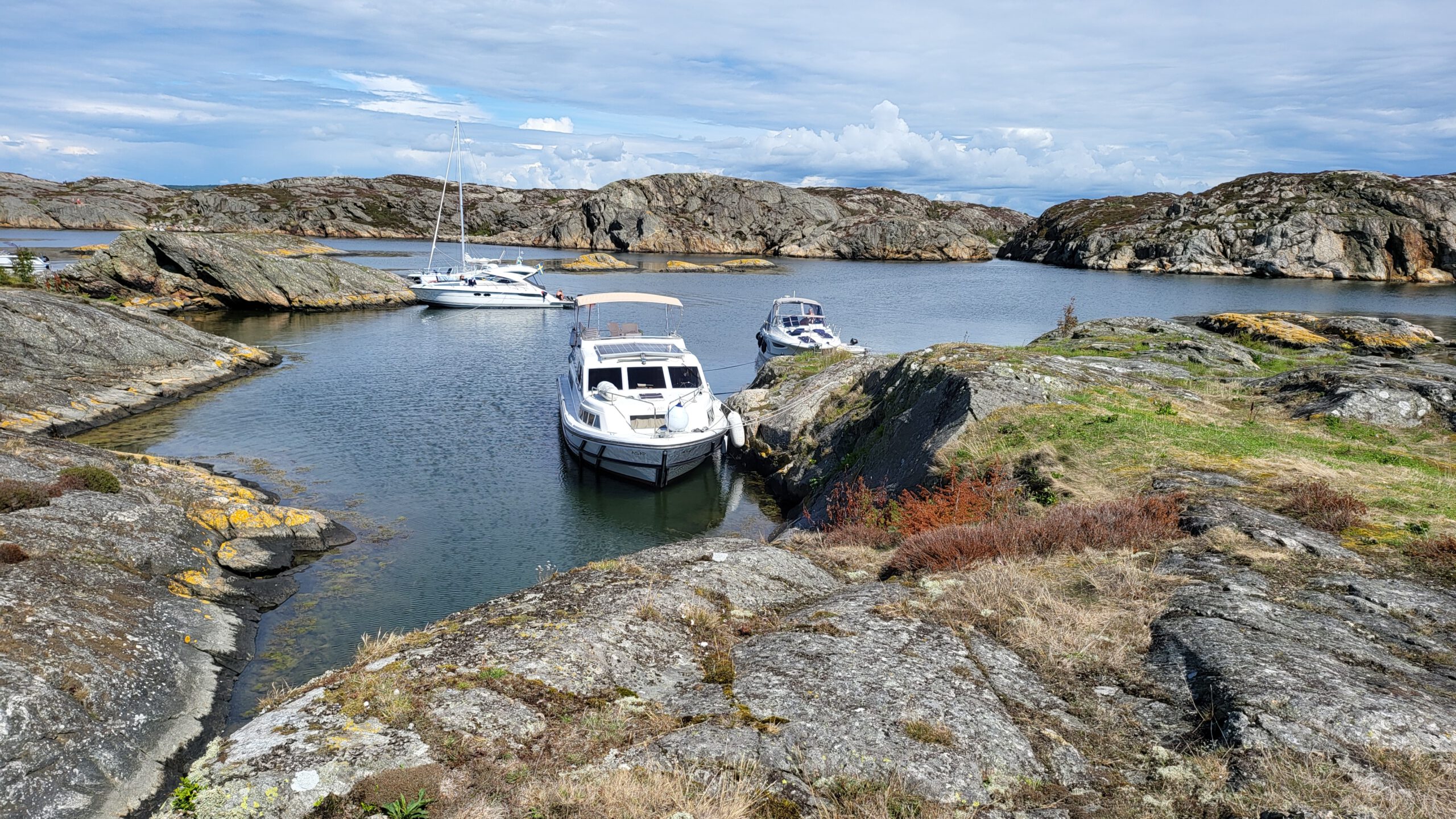
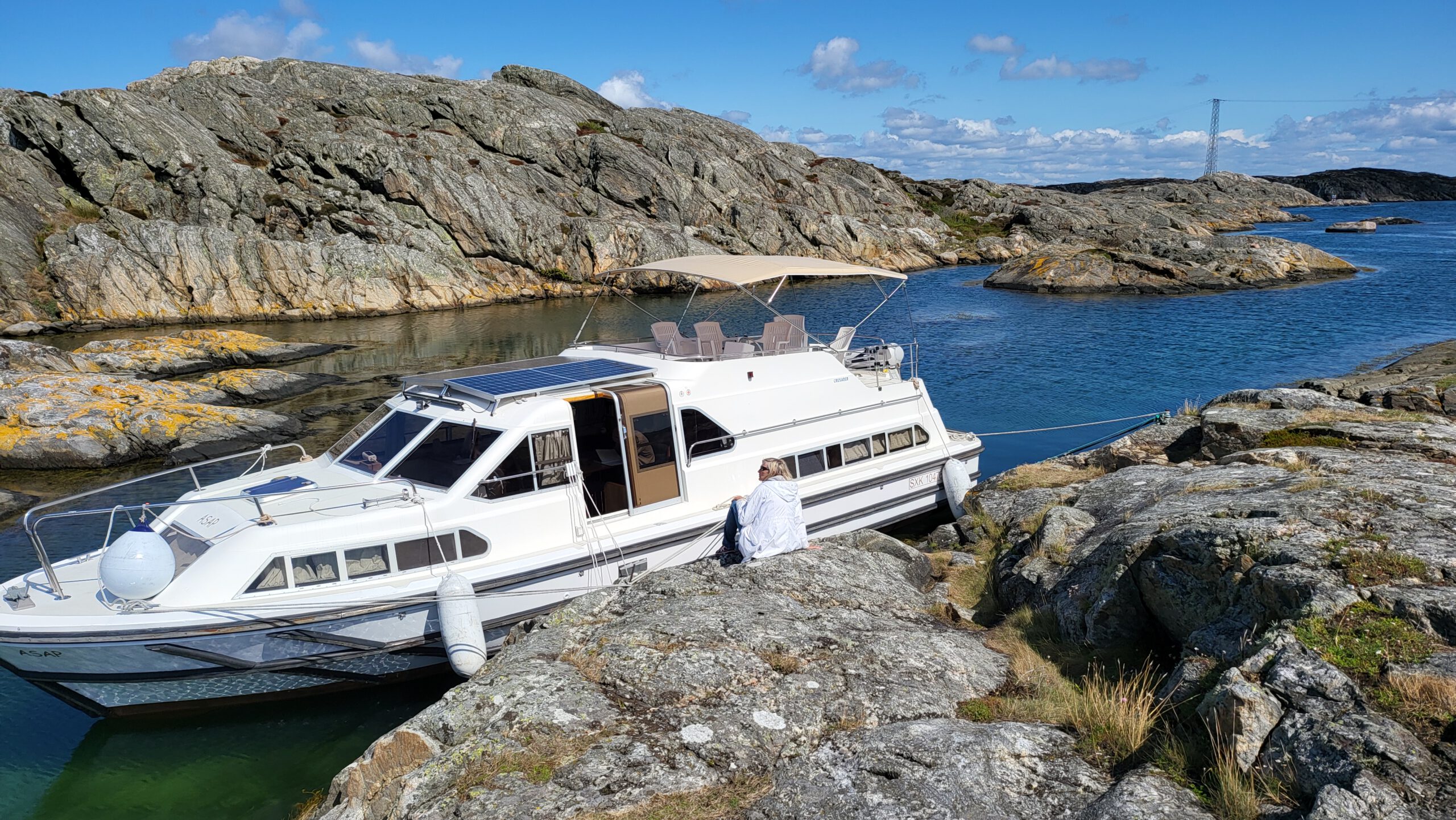
Many marinas are swamped by boaters in July, the main holiday month. However, between Gothenburg and the Norwegian border there is a multitude of sheltered places where you can moor your boat on anchor or directly tie up to an island. Using these mooring spots in nature are free and you only have to visit marinas occasionally to buy food and fill up water (preferably only for a couple of hours and then go back out into nature). Hence, avoid marinas in high season (end of June to early August) but use the multitude of free places outside marinas. There are hundreds of places between Gothenburg and the Norwegian border to moor your boat outside marinas. This book thoroughly describes 371 small marinas and sheltered free morings between Gothenburg and the Norwegian border: “Hamnguiden 5 (Harbour guide 5)” (in Swedish but with high quality pictures). A few of them:
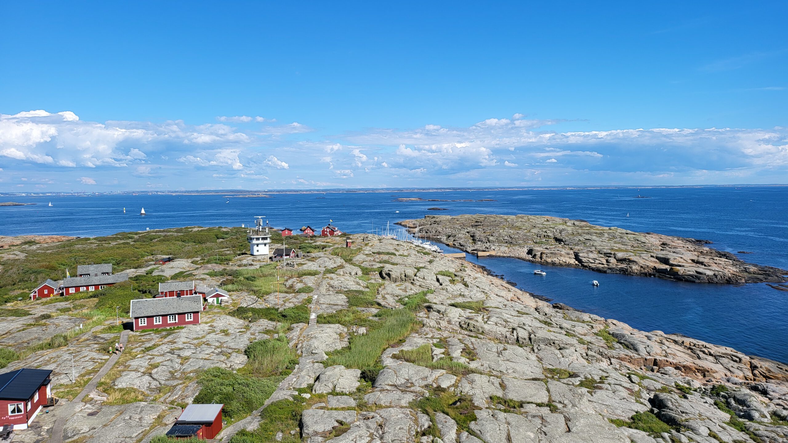
- Vinga west of Gothenburg is not a nature mooring but a very small marina run by a non-profit organisation. It has an interesting history and the light house as well as the museum is worth a visit.
- Stora Högö is a protected lagoon south of Marstrand. The lagoon has several mooring buoys but you can also tie up directly to the rock if your boat has a shallow draft.
- Stora Vrångsholmen south of Skärhamn offers good protection for most wind conditions.
- Altarholmen consists of one island with a few smaller around. It is a safe place in most weather conditions but may be tricky to reach in case of strong winds.
- Norra Smögholmarna southeast of Mollösund offers several mooring spots where you can tie up directly to the rocks. Some of these spots offer good protection in any weather.
- Södra Smögholmarna is a very nice place but it is a tricky navigation to enter and that should only be done in good weather.
- Hamnholmarna is a free moring between a few small islands. This has been used since the 14th century as a safe haven in bad weather (shown by old rock carvings from previous visits dating hundreds of years back in time). A video clip:
–The Bohuslän museum about Hamnholmarna (in Swedish) - Väderöarna (The weather islands) is a small archipelago of islands west of the small town of Fjällbacka. There are several sheltered places for a boat. Storö is the main island with a small harbour (not sure if there is any fee) but there are other places besides Storö. A few clips:
–The inn at the Weather islands (run by the two sole permanent residents in this archipelago)
–Weather islands - Kosterhavet National Park is made up of two islands, Nordkoster and Sydkoster. Cars are banned here. Walking on “Nordkoster” is very beautiful and if you do don’t miss walking to the northern beaches. South of Sydkoster is a beautiful archipelago with places like Ursholmen, Tjälleskären and many more. This little archipelago has many places where you can moor your boat for free. A few introductory films:
–Introduction to the Swedish Kosterhavet national park and the adjacent Norwegian Ytre Vhaler national park.
-Kayaking in the Kosterhavet national park.
Skippo and Hydrographica navigation tools
“Skippo” (formely named “Eniro på sjön”) is a simple navigation tool. There is a free version with charts for Sweden but you get more functionality with a paid version (labelled “Pro”). Skippo can be run on android, apple and windows Pc. The apple version seem to be in several languages including English (probably also the android version but I have not seen that). The navigational charts for Sweden in the Eniro på sjön app comes for free but the free version requires continuous internet connection (which usually works fine). Within app paid subscriptions that can be added on:
- The pro-version allows you to download the charts and navigate offline. The pro-version also give you a lot of other functions. The pro version costs (in 2022) 179 SEK (approximately 18 Euro) annually.
- If you download the Danish Skippo app you can add Swedish waters as an add on. Similarily if you download the Swedish Skippo app you get the option to add on Danish waters. This add on costs approximately 25 Euro annually.
- “Hamnguiden 5 (Harbour guide 5)” can be added as an extra subscription. It provides the text from Hamnguiden 5 as well as any pictures from it. It also contains Hydrographicas charts as separate pictures (but they are not part of the navigational chart shoving your boat).
- My best recommended add on: Hydrographicas charts as part of the navigation chart in Skippo ad more detailed information for relevant parts of Swedish waters (of special interest to leisure boats). Especially useful is the multitude of detailed descriptions on nature moorings (see image below). You can see your own vessel on the chart. The cost for Hydrographicas charts are 199 SEK (approximately 20 Euro) annually. The information in Hydrographica’s charts are the same as what you find in the above mentioned book (Hamnguiden 5). Please note that you can only add Hydrographicas charts if you have the Swedish Skipo app and you can only download the Swedish Skippo app when you are in Sweden. Examples of the information added by Hydrographocas charts:
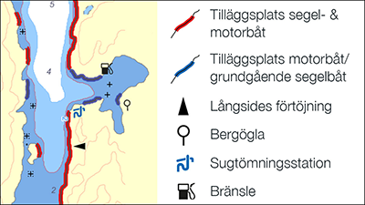
Tilläggsplats segel- & motorbåt = Possible to moor sail- or motor-boat
Tilläggsplats motorbåt/ grundgående segelbåt = Possible to moor motorboat or sailboat with shallow draft
Långsides förtöjning = Possible to moor directly alongside. (without this arrow you should have a stern anchor and attach the front of the boat to the rock.
Bergögla = There is a small metal pole where you can attach your line. There is no cost for using these. Without this symbol you have to use your own archipelago anchor fastening yourself (can be purchased at various boating supply shops).
Sugtömningsstation = Pump out station for black water tank
Bränsle = Fuel station for boats
Miscellaneous links
- Svenska kryssarklubben (Swedish boating association)
- Gästhamnsguide – Västkusten (Marinas along the west coast of Sweden)
- Sjömackar – Västkusten (Fuel stations for leisure boats on the Swedish west coast)
- Marinwebben.se (marine electronics)
- Hjertmans (boating supplies)
- Sea Sea (boating supplies)
- SVB (boating supplies)